|
|
|
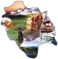
Himachal Pradesh is located in North West in India in the lap of the Great Himalayas . It is bordered by Jammu and Kashmir in the North , Punjab in the West , Haryana and Uttar Pradesh in the South and Tibet in the East. This beautiful state is divided into two parts Southern and Northern Himachal. The southern Himachal also known as lower Himachal is as hot as plain areas ,where as upper is Northern Himachal less hot in Summer and extreme cold and heavy snow in Winter. Himachal Pradesh is a tiny hill state whose pleasant summers make it a popular holiday resort. The Raj still lingers in Shimla, the state capital and former summer capital during British rule. Kullu-Manali are neighbouring resorts, surrounded by pine covered hills and lush meadows. Himachal has, in addition to popular resort towns, a series of secluded hill retreats ideal for interested anglers, trekkers and those wanting a quiet getaway. Many of these include: from Shimla Mashobra, Kufri, Naldehra; those around Kullu-Manali include Manikaran, Naggar and Brighu Lake; the barely accessible valleys of Lahaul and Spiti are a trekkers delight. The state has democratic form of goverence , like any other Indian State. The people of the state elect their representatives every 5 years . The State Assembly or Vidhan Sabha has 68 M.L.A.'s (Member of Legislative Assembly). The state has the following districts in the state :-
|
|
|